Vista Lucia Specific Plan
Carousel content
A carousel is a rotating set of images, rotation stops on keyboard focus on carousel tab controls or hovering the mouse pointer over images. Use the tabs or the previous and next buttons to change the displayed slide.
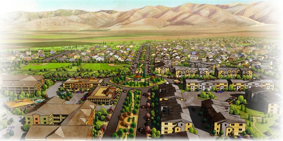
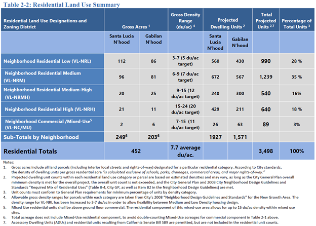
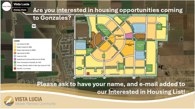
The Vista Lucia Project will provide guidance for the development of up to 3,498 residential units, comprised of single family and multifamily units, along with two commercial mixed use centers, three school sites, and recreational facilities that will include parks, playfields, trails, plazas, community gardens, and neighborhood squares – over a period of 20-30 years.
The City is committed to keeping residents informed as we move into the next step in the annexation process. Interested residents may call City Hall at 831-675-5000 to be included on our Notification List.
KSBW
https://www.ksbw.com/article/gonzales-approves-vista-lucia-affordable-housing-project/65987537
Monterey County Weekly
Carmel Pine Cone – Front page, lower right corner
CITY COUNCIL
TUESDAY SEPTEMBER 2, 2025 AT 6:00 PM
City Council Public Notice for September 2, 2025, Final (Spanish)
City Council Public Notice for September 2, 2025, Final
-----------------------------------------------------------------------------------------------------------
PLANNING COMMISSION HEARING
MARCH 10, 2025 AT 6:00PM
Planning Commission Public Notice for March 10, 2025 Final (Spanish)
Planning Commission Public Notice for March 10, 2025 Final
Resolution No. PC 2025-01 CEQA
Draft Resolution No. PC 2025-01 CEQA
Vista Lucia Project Final EIR
Draft EIR
MMRP
CEQA Findings
Resolution No. PC 2025-02 Specific Plans
Draft Resolution No. PC 2025-02- Vista Lucia Specific Plan
Draft Vita Lucia Specific Plan
Vista Lucia SP Appendices A and B Design Guidelines
Resolution No. PC 2025-03 Pre-zoning
Draft Resolution No. PC 2025-03 Pre-zoning
Prezoning Exhibit
Resolution No. PC 2025-04 Development Agreement
Draft Resolution No. PC 2025-04 Development Agreement (DA)
Exhibit A Development Agreement
Resolution No. PC 2025-05 Tentative Map
Draft Resolution No. PC 20025-05 Tentative Map
Exhibit A TM23-01 Tentative Map
Exhibit B Final Council Approved Vista Lucia Conditions of Approval ( September 2, 2025)
Exhibit B1 Major Improvements Timing
Resolution No. 2025-06 Annexation
Draft Resolution No. PC 2025-06 Annexation
Exhibit A Record of Survey Annexation Area
Exhibit B Vista Lucia Plan for Services
The Coming Vista Lucia Community Addition to the City of Gonzales
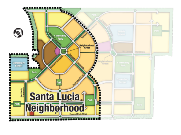
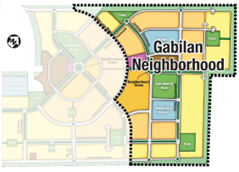
Vista Lucia is a master-planned community, comprised of two neighborhoods, with residential and commercial ne ighborhoods connected by design features that support sustainable development, and cultural, recreational, and civic amenities that encourage active and vibrant living.
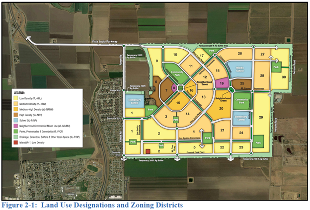
The Vista Lucia Specific Plan (VLSP, Specific Plan) will regulate and provide guidance for the development of up to 3,498 residential units, comprised of single family and multi-family residential units, along with two commercial/residential mixed-use centers, elementary school sites, a middle school site, and recreational facilities, including parks, play fields, trails, plazas, community gardens, and neighborhood squares. In addition, a pedestrian promenade system that interconnects residential and commercial areas within and between the two neighborhoods is included. Bike trails, detention and drainage areas, and other open areas will be incorporated into the open space system.
Development of the proposed project would occur over multiple phases, depending on market demand and the ability to provide adequate infrastructure. Infrastructure will be available prior to occupancy, thereby maintaining fiscal neutrality for the City.